EXPANDED PROFILE Mr
Dawney has over 40 years experience as a geologist in exploration
for mineral & energy commodities, including gold, base metals,
coal, uranium, petroleum, and to a lesser extent tin, industrial minerals,
platinum, mineral sands, bauxite, opal & other gemstones
- as well as geological experience in other land uses such
as rural, environmental & land development.
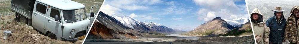
He has physically worked extensively throughout Australia, as well as in China,
Kalimantan (Indonesia), Burma (Myanmar), Sweden, Pakistan,
Kyrgyzstan, Botswana (Africa), French Polynesia and both North and South Korea, and has undertaken
desk-top studies from his home base for PNG, India, Turkey,
Peru, Chile, Argentina, and Irian Jaya (Indonesia), as well as completing a compilation of global geology.
Since 1983, Mr Dawney has operated as an independent consultant,
and has broad experience at all levels and phases of exploration
from project generation and "grass-roots" exploration
through to resource delineation. Currently he is the principal
of consultancy company AUSMEC Geoscience which
has been operating since 1993.
His fields of special competency include:
- Geological terrain analysis using digital data and GIS
- involving capture, compilation, integration and interpretation
of exploration related datasets, leading to exploration
target generation - from national to prospect scale.
- Mineral project evaluation, including literature research,
field investigation and due diligence-type studies.
- International aid projects in developing countries -
involving formal training (both abroad and home base), on-site
assistance, development and implementation of sustainable
methodologies, mineral and administrative policy - for mineral
exploration, government data provision and exploration promotion.
- Government-industry liaison - from Australian Federal
and State governments to aid recipient governments - for
standards, policy, methodologies and products related to
the exploration industry.
- Application of Geographic Information Systems (GIS),
terrain modelling, 3D visualisation and imagery for mineral
exploration, rural, land development, engineering and environmental
industries.
- Analysis and interpretation of exploration geochemistry
- including advanced statistical and graphical (thematic)
spatial analysis.
- Hands-on field geology operations in a range of environments
including remote, rugged and extreme environments. Specialising
in stream, rock, soil/RAB, glacial till sampling programs,
drilling programs and geological mapping.
- Geological data capture in digital GIS format (including
point, line, polygon and image data - particularly vector
spatial data), and publication quality map production -
predominantly in the MapInfo software environment.
- Training - courses, seminars, workshops, phone support
services and in-service training - related to mineral exploration,
MapInfo software and GIS.
- Geological interpretation of remotely sensed images,
including air photo, satellite and geophysical images -
formally trained as an image interpreter and tutored by
some of the most respected interpreters in the world.
Specialised experience in operating in developing countries
has been gained from his work in Indonesia, China and Kyrgyzstan,
and from two Australian International Development Assistance
Bureau (now AusAID) assistance programs in Burma (Myanmar)
and Pakistan which provided on-site exploration assistance
and training. Through this overseas work, Mr Dawney has gained
experience in the cultural and religious sensitivities necessary
for effective working and training relationships in these
and similar countries.
Apart from Mr Dawney’s hands-on, project-oriented work,
he has delivered a number of formal and informal courses,
workshops, seminars and project displays related to the AusAID
Pakistan project, and has been a course presenter for three
Australian Mineral Foundation (AMF) training courses on mineral
exploration and two AMF sponsored in-service training courses
for photogeologists. He is also a co-author of a manual for
early-stage, integrated, regional gold exploration. He has
presented conference & seminar papers, given workshops
on GIS applications for exploration based on his practical
experience, carried out MapInfo software training, and has
contributed to articles in national resource industry magazines
as a respected professional.
He has previously been involved in the management of a number
of private and public exploration companies and is currently
an executive director of Lake Gold Pty Ltd, which commenced
exploring in Australia (predominantly Queensland) in 1985,
and is now involved part-time in investing in emerging exploration/mining
companies.
Mr Dawney has also acted as an expert geologist in preparing
reports and arguments for use in Queensland courts, and has
appeared on the stand in these courts as an expert witness.
He also advises government through his activities with industry
support groups (predominantly the Queensland Resources Council).
Although a specialist user of computer programs for geology and exploration,
he maintains very good field fitness and engages in field programs at all
levels whenever possible, so as to remain grounded by geological reality.
| Qualifications:
|
BAppSc-App
Geol (Queensland University of Technology) - 1977
- Brisbane, Australia |
| Affiliations:
|
Member,
Association of Applied Geochemists - AAG |
| |
Associate
Member, Queensland Resources Council - QRC |
| Nationality:
|
Australian
|
|
|