GIS
or Geographic Information Systems are computer-based
systems that provide mechanisms for data organisation & analysis,
and rapid visualisations of georeferenced data (commonly referred
to as spatial data)
GIS
Applications
- At AUSMEC we
provide GIS applications for mining exploration and other
land uses - e.g. rural, environmental, land development.
- Included in
these applications are data management, manipulation, interpretation
and presentation - including database design and setup.
Digital
Data Capture
- Specialising
in spatial vector data
- Geological data
digitising & general digitising
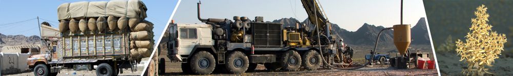
- Exploration
data capture
- Elevation
data capture
Digital
mapping involves the use of various software programs
to:
Generate
digital map data from non-digital formats such as paper copies;
store, modify and manipulate digital files; display map data
on screen, and produce various outputs such as PDF or printed
maps.
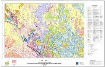 
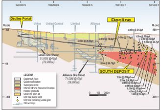
Complex GIS/Geological Mapping
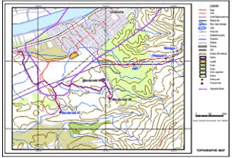
Topographic Mapping
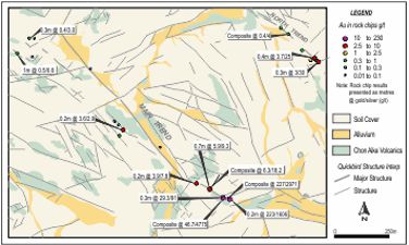 
Summary Gold/Silver assays
Geological Cross Section
|